Seabed Prehistory - Tom Goskar |
|
Tom Goskar is an archaeologist who specializes in 3D visualisation of archaeological sites - from Roman temples, to entire prehistoric landscapes populated with animals and families. He is also a keen podcaster and blogger
Vue Experience
"I first used Vue d'Esprit 2 in 1999 and was amazed at how quickly I could create whole landscapes, which could be beautifully lit, with gorgeous skies. I rediscovered Vue in 2002, and have been using it to produce our reconstructions ever since."
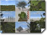
"The ability to create huge landscapes that can be populated with vegetation and set in beautiful environments is invaluable to me. In prehistory, much of the UK was covered in thick forests that were slowly cleared as we discovered agriculture, over 6000 years ago. Most of the scenes I create involve large quantities of trees, bushes, weeds and grass. Vue's EcoSystems have allowed us to bring a whole new level of realism to our work, and we couldn't be without it!"
About the project
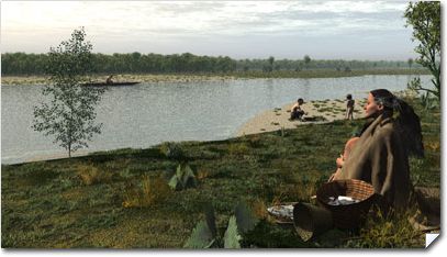
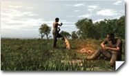
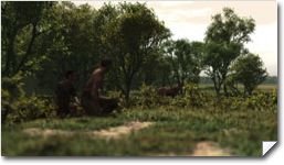
"During the early prehistoric period (700,000BC to 6000BC) sea level varied greatly. Water was locked away in ice sheets and released as the climate changed. At times, Britain was no longer an island, but a peninsular of mainland Europe. Parts of what is now the English Channel were inhabited by families who would have gathered edible plants and hunted for meat and fish."
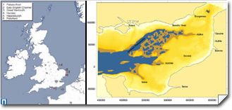
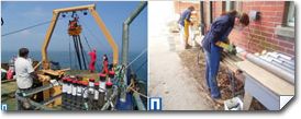
"In 2003-2004, Wessex Archaeology began a project to apply geophysical and geotechnical survey methods to areas of prehistoric interest. We could build up a picture of what these submerged landscapes might have been like. During the project, some man-made flint tools were recovered from 35m under the sea, dating to the Mesolithic (about 9,350 years ago), so we know that people had lived or hunted there."
"In early 2005, sufficient data was available to begin to make a real, 3D, impression of the appearance of our 3km X 1km study area. We could use the model to test hypotheses and help us to challenge our dataset, by actually visualising it in as tangible way as possible. Vue helped us to see this data in a whole new light."
"It took us about 8 weeks to complete, but we had many meetings about it for a couple of months before. We discussed how we could use the evidence that we had collected, and how to show the different zones within our study area. We produced a handwritten description of each scene in sequence, and built the scenes out of them, regularly showing the rest of the team our test renders."
"The plants that had to react to wind were built in Vue's Plant Editor. We used XFrog to produce some of the plants, and used the XFrogPlants library. Adobe Photoshop CS was used for treating textures."
"The landscape in question is now under the sea, but 10,000 years ago it would have been a rich river estuary.
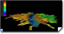
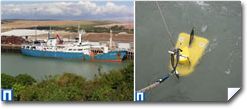
We rebuilt the landscape using seismic data collected using equipment on a boat, to build up DEMs which were imported into Vue."
"The DEM was split into 6 areas, to reflect the different areas of vegetation, such as salt marsh and dense forest - the vegetation areas had to be as accurate as our data. We created 6 terrains, clipped and stacked them to create a landscape that looked whole, but allowed us to select zones. We then populated each zone with appropriate trees and plants, and created cubes of a known height to ensure plants were at the right scale. Our final model contained billions of polygons, and over a million items of vegetation."
"The next challenge was importing models from Poser.
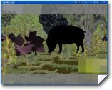
We sourced and built people, painted clothes maps, added animals, and brought them through into Vue.
Animations would take days for just 15 seconds of frames, and the challenge was waiting to see if any of the people sank into the ground or walked though trees!"
"I worked with Chris Stevens and Karen Nichols to complete the model. Without these people, I wouldn't have been able to finish it, and I'm deeply grateful to them."
Tips and tricks to share with the community.
"If you are going to create images of the past, carefully research what the natural environment was like back then.
What species of plants are likely to have been growing where your scene is set?
Try to source models of these plants - getting the right vegetation is vitally important if you want to understand how people lived in the past (and how it looked!)."
Current Project
"This project is funded by the Aggregate Levy Sustainability Fund (ALSF), administered by the Mineral Industry Research Organisation (MIRO) under the Sustainable Land-Won and Marine Dredged Aggregate Minerals Programme (SAMP)."
"We have just finished working on a series of stills and animations of the archaeology underneath London Heathrow's new Terminal 5 development, using Vue Infinite, Poser and Sketchup. http://www.framearch.co.uk/t5/"
http://www.wessexarch.co.uk/projects/marine/alsf/seabed_prehistory/index.html
www.wessexarch.co.uk
-
Have you created an interesting project with the help of one of our products? Would you like to see your work showcased here, and benefit from e-on's exposure?
Get in touch with us! Contact press@e-onsoftware.com.
-


